The area has been occupied for thousands of years. For example, an early Bronze Age (c. 2000 BC) barrow cemetery has been found in Lockington. During the Iron Age and Roman occupation, the area was occupied by the ancient British Coritani/Corieltauvi tribe. Romano-British sites have been identified at Red Hill and Lockington.
In about 80 AD the Romans built a road from Derventio (now Little Chester in Derby) to Sawley, probably to cross the Trent by ford. There are still traces of a Roman marching camp in a field near the church. Derventio was a small Roman town in what became the province of Flavia Caesariensis in the early 4th century. Draycott Road follows approximately the alignment of the old Roman road. In the 5th century Roman influence dwindled as their empire collapsed and the Anglo Saxons arrived on the coast of (what became) England.
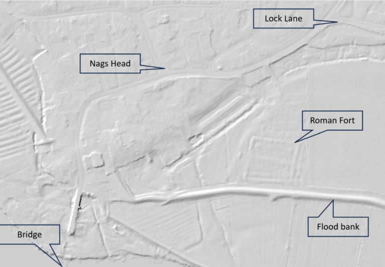
Despite being a temporary structure built 2000 years ago, the Roman fort can be clearly seen on this Lidar (Laser Radar) image of the village (see also the note about medieval fishponds below).
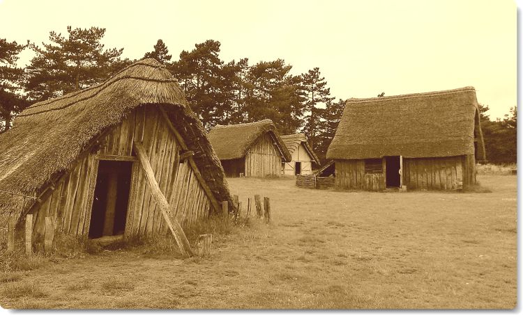
There are no firm indications of anyone permanently living in Sawley before Angles came up the River Trent, possibly in the late sixth century or early seventh century. They settled on the rising ground where the parish church now stands. Because the ground was originally covered with sallow willows, salh in Anglo-Saxon, they called it ‘Salloe’ or ‘Sallé’, meaning the hill with willows, and this eventually became ‘Sawley’.
Sawley became part of the Anglian kingdom of Mercia. In 775 Offa, King of Mercia made Tamworth his capital. All roads led to Tamworth, and the highway from Salloe became Tamworth Road.
The period 716-796 was later known as the Mercian Supremacy, with Mercian kings Æthelbald and then Offa ruling over most of England. Thereafter, the West Saxons (Wessex) became dominant, whilst the country began to be raided by Danish Vikings. A Viking fleet, which sailed up the Trent to Repton in 854, may have attacked Sawley on the way and burned Sawley Church. In 867 the Viking ‘Great Heathern Army’ spent the winter at Nottingham. They returned in 874 and deposed the Mercian King. The Eastern half of Mercia became part of the Danelaw, under the Viking government in Jorvik (York). It’s likely that Viking settlers mixed with the local Anglo Saxon population. Wilsthorpe (Wifel’s outlying farm) is a Viking name.
The Danelaw South of the Humber was organised into large ‘boroughs’ controlled from fortified towns. The nearest such towns were Derby, Nottingham and Leicester. The boroughs were divided into wapentakes, each consisting of (in theory) a hundred households. Sawley was in the Morleston Wapentake.
In 918, King Alfred’s eldest daugher, Æthelflæd ‘Lady of the Mercians’ led an English Mercian army to recapture the area around Derby. Danish terms were replaced by the Anglo-Saxon equivalents, so the boroughs around Sawley became the shires of Derby, Nottingham and Leicester and Morleston Wapentake became Morleston Hundred (later Morleston and Litchurch Hundred).
Sawley belonged to the Diocese of Lichfield, presumably after having been given to the church by an Anglo Saxon or Viking king. Which meant there was no change in ownership after the Norman invasion in 1066. The bishop, as lord of the manor, would have received rents from tenants, the income from his farming land, plus local legal fees and fines. The community of ‘Salloe Soke’ comprised Sawley with Wilne and Wilsthorpe, the hamlet of Draycott and Hopwell, and the lordship (land not let out to a sub-tenant) of Long Eaton.
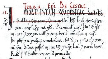
The Domesday Book of 1086 records that the bishop’s lands in Sawley, Draycott and Hopwell included 42 households (29 villeins or villagers and 13 bordars or smallholders), a priest and two churches (Sawley and Wilne), a mill, meadow, woodland pasture and a water meadow. The remains of a later water mill, dated to about 1140, have been found in gravel workings south of Sawley. The manor of Salloe was valued at £8 per annum, a considerable sum at the time. By the late 13th century this had risen to over £66, the third highest in Derbyshire (after Bakewell and Chesterfield).
In 1130 Bishop Roger de Clinton re-organised the finances of Lichfield Cathedral and transferred part of the manor of Sawley to a prebendary manor, the profits from which supported the cathedral treasurer. The other parts of the original manor remained under the ownership of the bishop. The cathedral treasurership was only a part-time role and the prebendaries either had to live at Sawley and take church services or appoint a vicar in their place. Sawley became so prosperous that the manor was known in the Middle Ages as the ‘golden prebend’.
Sawley was important not only because of its rich farmland, but also because it commanded a river crossing. The River Trent remained fordable at Sawley, except in times of flood, until weirs were constructed at the end of the 18th century. From the late 11th century to the early 14th century a bridge crossed the old course of the Trent a mile upstream of the current bridge.
In the Sawley Charter granted to the Bishop by King Henry III in 1259, Sawley became a town by being granted the right to a weekly market every Tuesday and an annual fair for 3 days at Michaelmas. Around the same time the first of several additions were made to All Saints Church.
The two parallel rows of humps and hollows on the far side of the field opposite Fairfield Crescent (also visible on the Lidar image above) are believed to be medieval fishponds, possibly belonging to a monastic house on the Church Farm site.
In 1549 the bishop sold his part of the manor of Sawley to Richard and Thomas Whalley, who sold it on to the Stanhope family of Elvaston. The Stanhopes (who later became the Earls of Harrington) leased the Manor of Sawley from the bishop from around this time into the 20th century.
For a time Nottinghamshire and Derbyshire held a joint assizes in Sawley.
Strip farming, whereby the tenants farmed strips of land in large fields, was used in Sawley throughout the Middle Ages, and there are several fields showing the ridge-and-furrow which is the legacy of this pattern of cultivation. Enclosure began, with consolidation of some holdings, in the 17th century, but the major enclosure took place as a result of the Sawley Enclosure Act of 1787. See also agriculture.
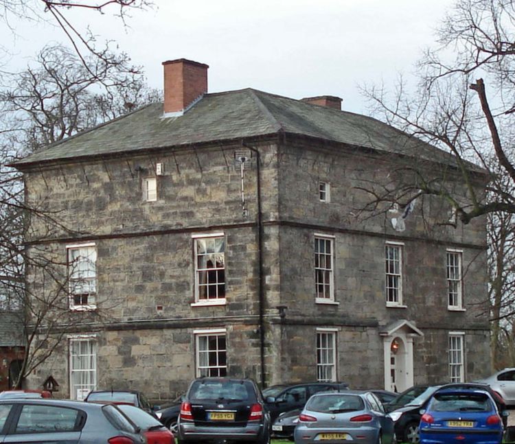
Bothe Family. The influential Bothe family are commemorated in striking monuments in the church and have also given their name to Bothe Hall, which in its present form is a Georgian mansion standing in its own grounds near the centre of the village. Dame Robert Bothe of Sawley became the Abbess of the Augustinian Convent of Grace Dieu in Leicestershire and was the Founder of the Order of The White Nuns.