The Trent flows 185 miles from Biddulph Moor in Staffordshire to the Humber Estuary. The name “Trent” is thought to be Celtic (pre-Roman ancient British), possibly meaning ‘strongly flooding’ or perhaps a contraction of the words for ‘over’ and ‘way’ as it could usually be crossed by fords.
The course of the river has often changed, even in relatively recent times. One old channel started about 400yds south of the (current) Derwent confluence and ran parallel with the current course until emerging just east of the aqueduct. The towpath still crosses a small stream here. Between this and the motorway bridge is a muddy pond, the ‘Hully Gully‘, which is probably another old course of the river. It seems that the earlier confluence with the Derwent was the original Wilden Ferry, which later moved upstream until it was replaced by the Cavendish Bridge.
Until relatively recently the county boundary ran along the original course of the river. During gravel extraction here archaeologists found the remains of medieval bridges over the old course of the Trent (see below).
Another cut off meander is the ox bow lake south of Wilne Road (under the M1 bridge). This used to be a local beauty spot known as the ‘Old Trent’. There are traces of another old section of the Trent (or the Soar?) between Trent Lock and Red Hill, around Sawley Cliff Farm, which seems to have originally been in Sawley parish.
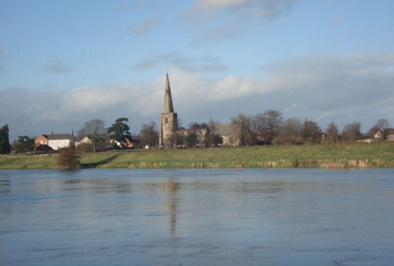
The Trent has a huge catchment area. Its main tributaries are the Tame, which flows through Birmingham, the Dove, the Derwent (joining near Shardlow) and the Soar (joining at Trent Lock). The Dove and Derwent drain the Peak District, so after periods of prolonged rain or melting snow the shallow middle and lower sections of the Trent are prone to flooding. Significant floods were recorded in 1141, 1309, 1795, 1875 and 1947. Perhaps it was the 1309 flood that washed away the Norman bridge and altered the course of the river near the Derwent mouth.
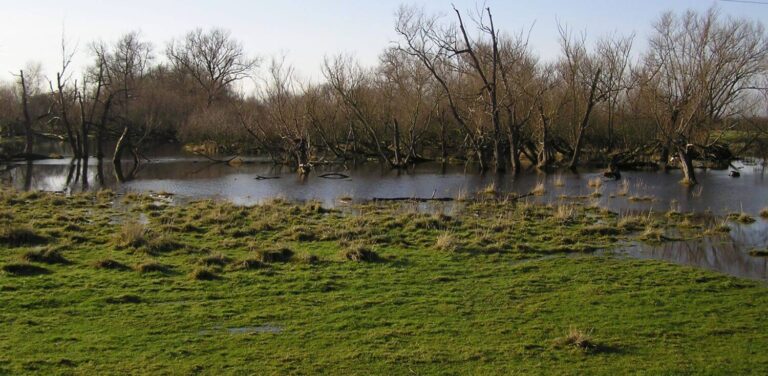
Sawley also had floods in 1932 and 1946. The improved flood defences have held since 1947.
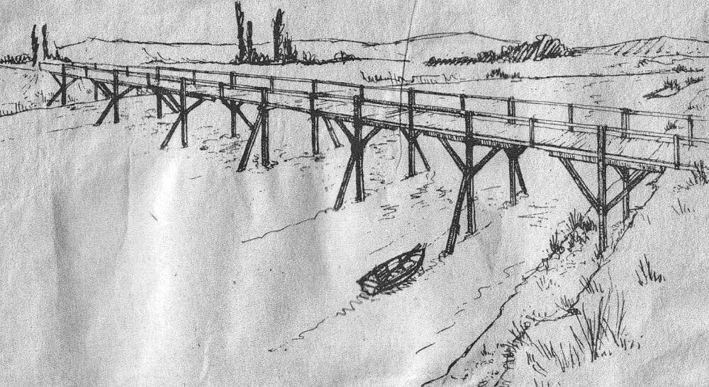
In 1661 the Trent above Sawley was so dried up that anyone could walk across the bed. In 1893, the Trent was frozen over thick enough to bear the weight of a horse and cart. Skaters were able to skate from Nottingham to Derby with only occasional breaks. Bonfires were lit on the ice to convince people of the thickness. When the ice finally broke up, it demolished the Long Horse Bridge. The 1795 flood also followed a harsh winter and the water and broken ice destroyed or damaged most of the bridges all along the Trent.
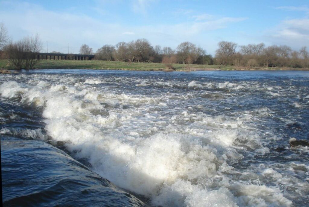
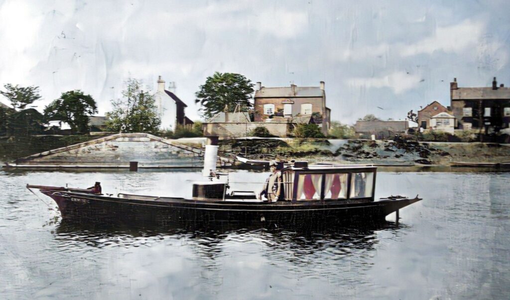
Great improvements were made to local river and canal navigation in the late 18th century. The Trent was made navigable to Burton following a 1699 Act of Parliament. The Trent & Mersey canal opened in 1777, joining the Trent at Derwentmouth (3/4 mile upstream from Sawley). The next year the River Soar was made navigable from Trent Lock to Loughborough. In 1779 the Erewash Canal was opened at Trent Lock. The Erewash Canal was connected to the Derby Canal at Sandiacre in 1795. The Trent Navigation Company was formed in 1783 to make improvements to the navigable stretch of the river, including dredging and consolidation of the main channel, improvements to the banks and towpaths, and erection of weirs. The two weirs at Sawley had to be bypassed by two short canals, or ‘cuts’, the Sawley Cut of 1793 and the Cranfleet Cut of 1795.
In 1805 the navigation from Shardlow to Burton was given up, by agreement with the owners of the Trent and Mersey Canal. The Derwent was originally navigable up to Derby, until the Derby Canal was opened in 1794.
Ferry & Medieval Bridges
During gravel extraction south of the Derwent Mouth archaeologists found the remains of medieval bridges over the old course of the Trent. The first timber bridge was built in the late 11th century (soon after the Norman invasion) and when this was washed away, a second timber bridge was built. After this in turn had been washed away, a masonry bridge was built, and this survived for some 80 years, until the early 1300s. It was almost certainly destroyed by floods. Perhaps the river changed its course at the same time.
The Trent was usually fordable at Sawley until weirs were constructed at the end of the 18th century. A Sawley Ferry began in 1321 and continued to operate until the Harrington Bridge was built, slightly downstream of the ferry, in 1789-90. The ferrryman’s house had been near the site of South Cottage.
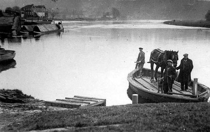
Ten years earlier, the canal companies had started a horse ferry across the river from Trent Lock, leading to the River Soar towpath and Cliff Farm. This continued for many years. The scouts still operate a ferry slightly upstream of the horse ferry. Further downstream were ferries to Thrumpton (from Pasture Lane, Long Eaton) and to Barton (from Barton Lane, Attenborough). These services were finally forced to close in the mid-20th century because of the expensive insurance required by the river authority.
Billy Stones
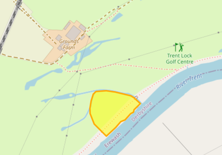
The area of the North bank of the Trent by Grounds Farm is known as Billy Stones. It is possibly the site of a ford, perhaps that used by the Romans. Roman pottery is reported to have been found in the river bank nearby in 1956.
Site of Billy Stones (Derbyshire Historic Environment Record)
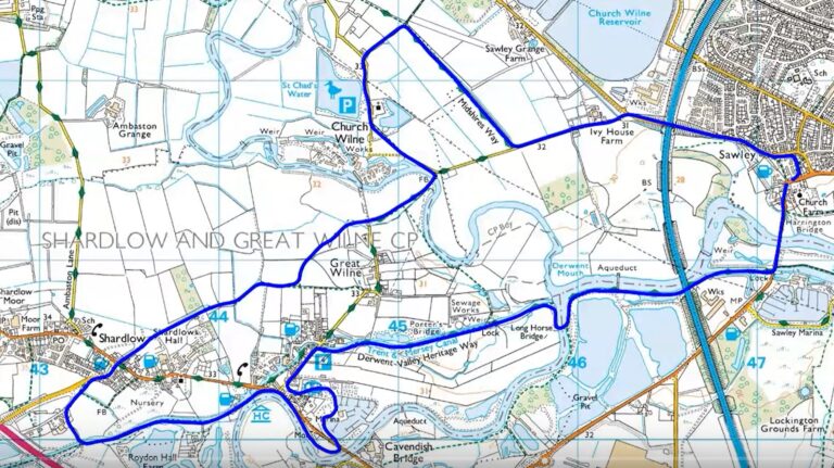
Video of a walk from Sawley, to Cavendish Bridge and Shardlow, then back via Church Wilne.